The Ligurian coast between the Palmaria archipelago and the Cinque Terre was given UNESCO World Heritage status because it is a “site of great value, where the harmonious interaction between humans and nature has created a landscape of exceptional scenic quality illustrating a lifestyle a thousand years old whose traditions continue to play a prominent role in the socio-economic life of the community”.
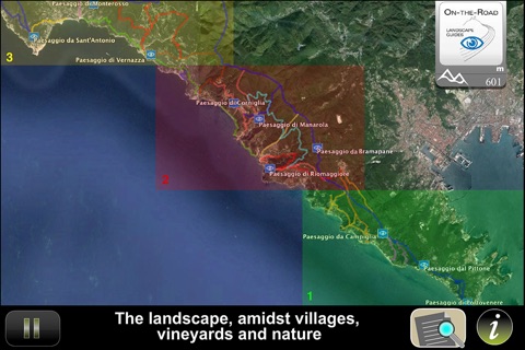
The On-the-Road guide for this territory offers an itinerary covering the 10 most beautiful and meaningful scenic areas lying between Portovenere and Levanto. Every point on the itinerary is provided with a navigable panoramic photo and an audio that describes the territory shown, pointing out its most characteristic elements such as villages, churches and other interesting sites. Each element is accompanied by detailed photos and/or informative files consisting of a descriptive text and photo gallery.
The guide works offline and recognises the points where you will be finding yourself thanks to the GPS system on your smartphone or tablet, and you yourself can decide whether the guide should turn on automatically or just beep you when you are approaching the point of interest, after which you can turn it on using the push button.
All the scenic points and elements of interest are geographically referenced, providing the coordinates to be input into your GPS.
The map of the itinerary also includes the network of trails in the area and information useful in following them.
The guide consists of
- 102 photo 11 of which large size and panoramic
- 23 informative files consisting of a descriptive text and photo gallery
- 18 minuts speech
- 4 maps
- Footpaths list and related information


